Table of Contents | ![]() Print This Page
Print This Page
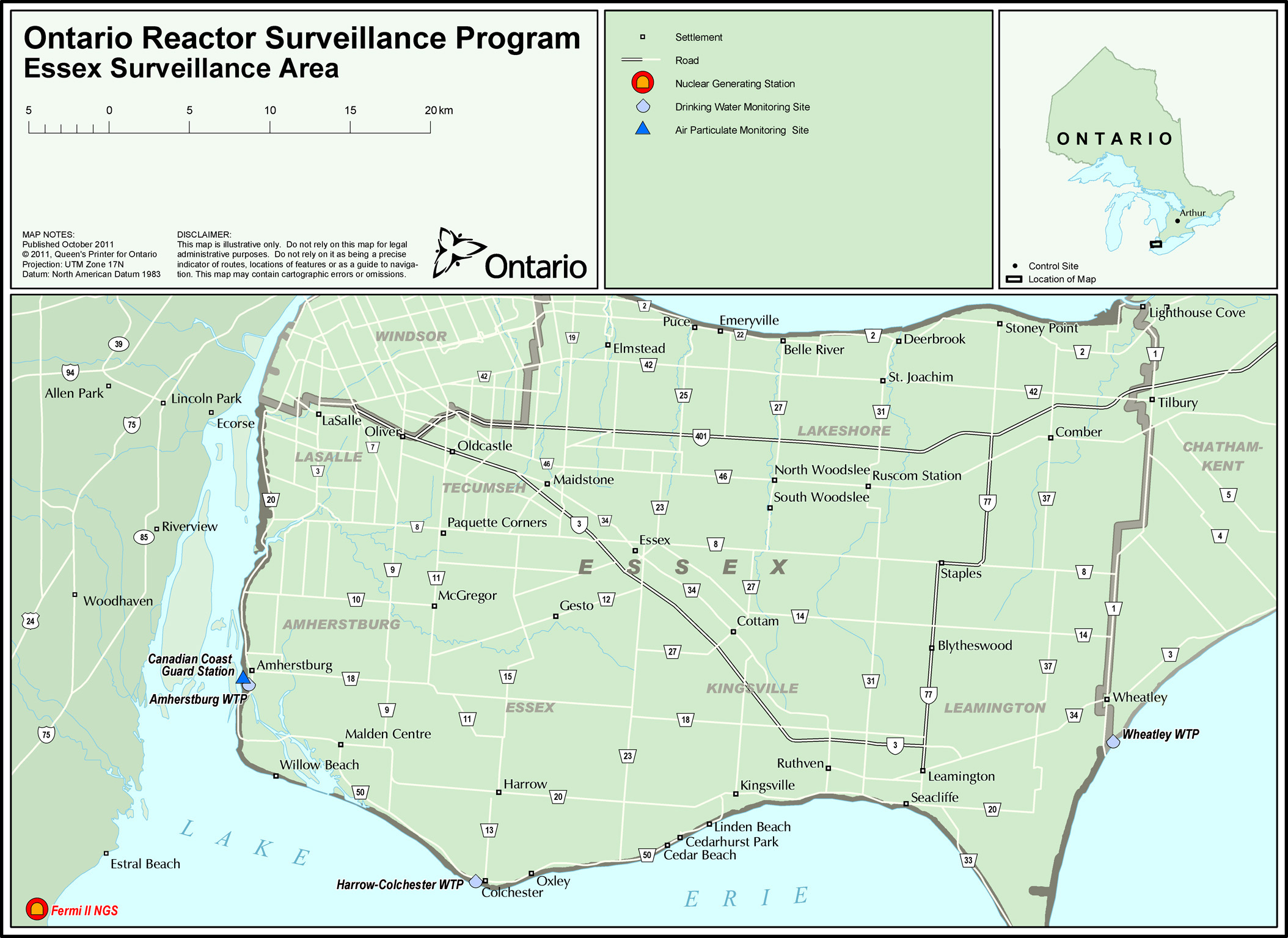
Map 4 Essex Surveillance Area
- Issued: July 17, 2013
- Content last reviewed: September 2014
Summary
This map shows the surveillance area for Fermi Nuclear Generating Station in USA. The monitoring sites include: drinking water and air particulate.
Map Area
The map boundaries are: the Fermi station on the USA shores of Lake Erie to the southwest, Windsor township to the north and Chatham-Kent to the east. The northern shore of Lake Erie forms the southern boundary from Amherstburg to Wheatley.
Map Detail
The chart below indicates the distances of the monitoring sites and other key marked points from the Fermi Nuclear Generating Station.
| Name/Location | Air Particulate |
Drinking Water | Distance from Fermi NGS (km) |
|---|---|---|---|
| Fermi II Nuclear Generating Station | 0 | ||
| Canadian Cost Guard Station | Yes | 19 | |
| Amherstburg WTP | Yes | 19 | |
| Harrow-Colchester WTP | Yes | 28 | |
| Wheatley WTP | Yes | 54 |
Contact
If you require assistance interpreting the map please contact:
Phil Panter
Tel: 416-235-6045
E-mail: philip.panter@ontario.ca
#worksafeON | #workfairON